 Gustav
Explore Eremitageslottet in Denmark
Eremitageslottet, the Hermitage Hunting Lodge, sits on the highest point of the open plain in Jægersborg Dyrehave, just north of Copenhagen. It was built in 1734 to 1736 for King Christian VI, designed by the court architect Lauritz de Thurah, as a place for royal hunting parties to eat and rest.
Its most famous detail is one you cannot see from outside: the dining room had a table that could be lowered to the kitchen below and raised again fully set, so the king and his guests could dine without servants in the room. The lodge and the surrounding hunting landscape became part of a UNESCO World Heritage Site in 2015.
The building is only open inside on guided tours in certain periods, but the outside is there for anyone who walks or cycles through Dyrehaven. That is the part I captured.
The short version
- Photos236 photos from a Nikon D3500, taken on two walks around the lodge in January 2022
- Camera alignmentRealityScan, which worked out where every photo was taken and produced 350,000 sparse 3D points
- Splat trainingBrush, an open-source trainer, on a GeForce GTX 1070 from 2016. 60,000 steps, about four hours
- Result1.28 million splats, trimmed to 1.13 million and 36 MB for the web
- The walkA ring around the path I walked with the camera, so you only see angles the photos cover
Step 1: photos I took years ago
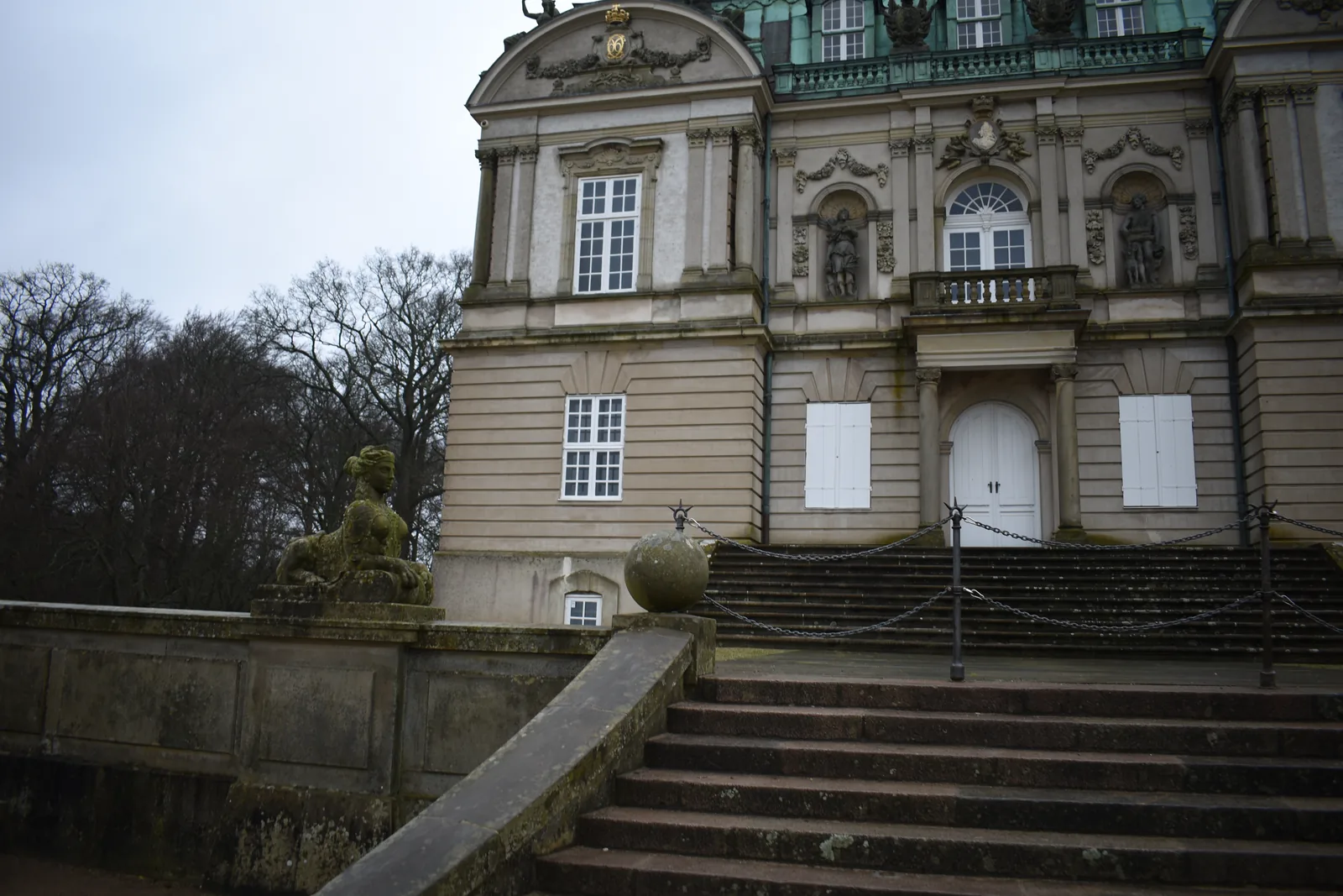
I did not plan this. The photos are from a winter walk in 2022, taken with an entry-level DSLR while circling the building at eye level. That turned out to be roughly what a splat needs: lots of overlap, the same subject from every side, and no strong sun throwing hard shadows.
Step 2: where was every photo taken?
Before a splat can be trained, the software needs to know exactly where each photo was taken and which way the camera pointed. I ran the photos through RealityScan, which matched features between images and solved all 236 camera positions, plus a sparse cloud of 350,000 points on the building.
Getting that into Brush took a detour. RealityScan exported the cameras as a spreadsheet of positions and yaw, pitch and roll angles, and how those angles should be read is not documented. So I tried every plausible way of reading them and kept the one where all the cameras pointed inward at the same building with their horizon level. The check that settled it: every one of the 350,000 points landed in front of the cameras and inside the photos.
Step 3: training the splat
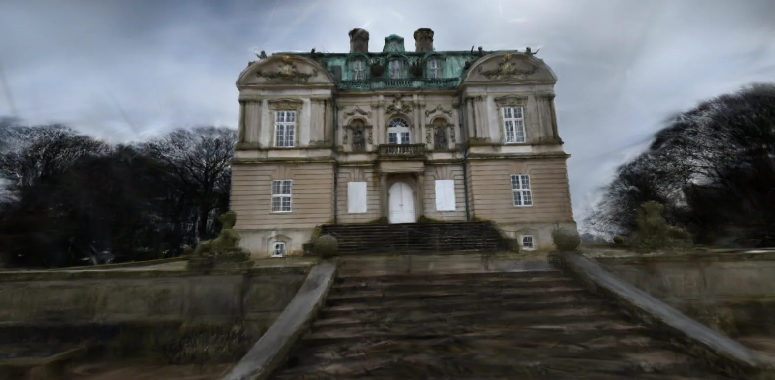
Brush starts from those 350,000 points and spends tens of thousands of steps moving, splitting, recolouring and deleting small soft blobs until renders from every camera match the photos. I watched it happen live in Brush's viewer, as the building went from a cloud of dots to something you could recognise.
It ran for 60,000 steps on the same ten-year-old graphics card as my orc splat, and it crashed twice along the way, both times close to a finish line. Because I had it save a checkpoint every 1,000 steps, each crash cost minutes rather than hours. That is the one setting I would tell anyone to change first.
Step 4: turning a splat into a walk
A splat viewer normally lets you orbit and fly anywhere. That is a problem with a photo-based splat, because it only looks right from roughly where the photos were taken. Fly above the roof and it falls apart.
So instead of free flight, the walk is built from the photos themselves. I took the 236 camera positions, smoothed them into one loop around the building, and let you walk anywhere within a ring around that loop, at the height I held the camera. The minimap shows the ring, and a note appears when you get near an area the photos barely covered. Space starts a guided tour that walks the loop for you.
What is not perfect
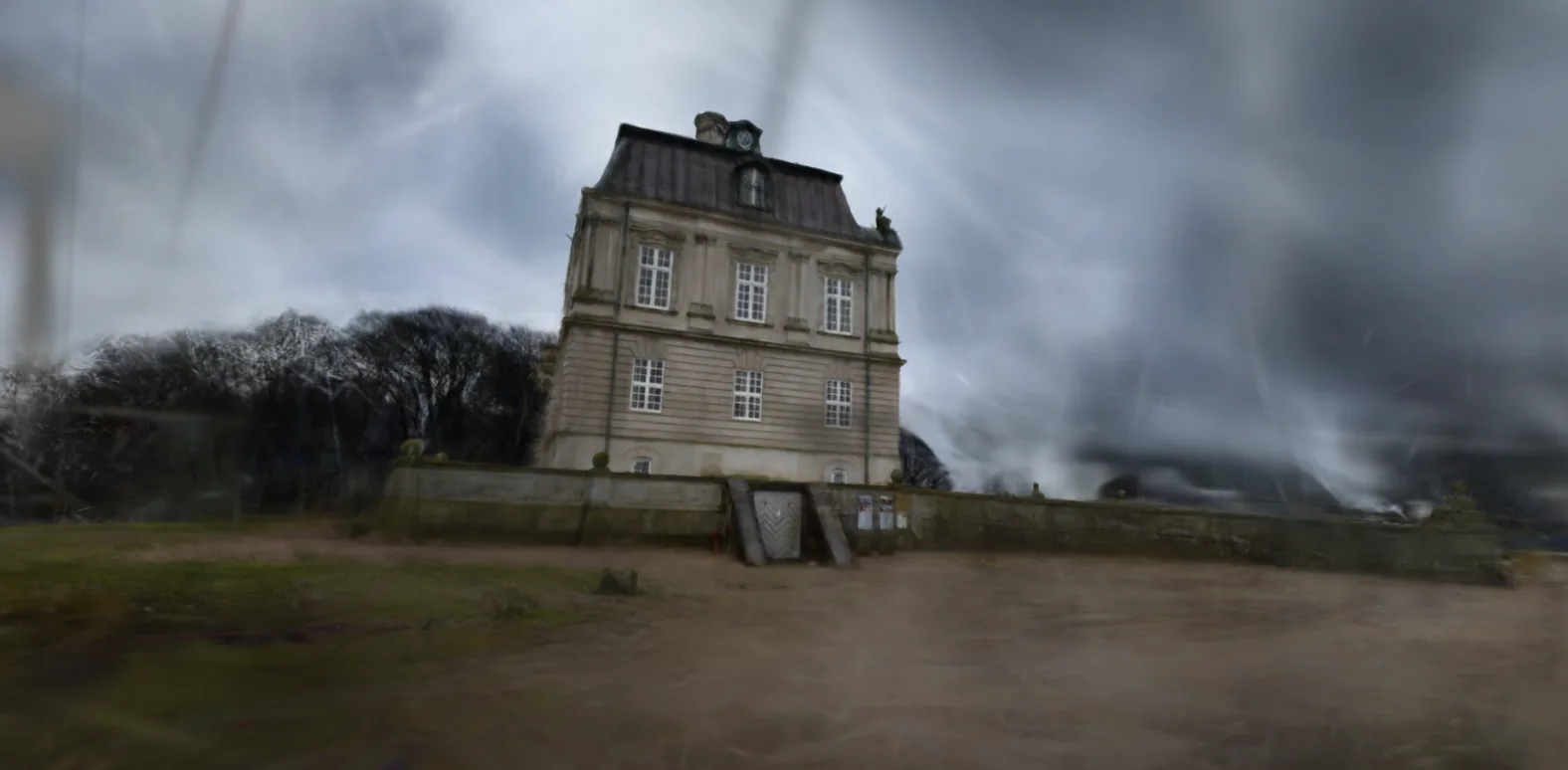
- The sky is streaky. Clouds move and sit at infinity, so no single 3D position explains them. The splat fills the sky with long smeared blobs instead.
- Thin things disappear. The iron chain railings on the front steps are clearly visible in the photos and almost gone in the splat. Very thin objects are hard for splats.
- The ground is soft. I pointed the camera at the building, not at my feet, so the gravel and grass close up are blurry.
The lesson for anyone planning a capture: the splat can only be as good as the angles you photographed. Walk all the way around, take more photos than you think you need, and include a few aimed at the ground and the roofline if you want those to hold up.
Why this matters beyond one hunting lodge
This was made from photos I already had, with a free trainer and an old graphics card. The same approach works for a shop interior, a property for sale, a museum object or a heritage site that deserves to be seen by more people than can visit it. I wrote about that last case in 3D scanning for historical preservation, and this is the most direct demonstration of it I have made so far.
A splat in a browser needs no app, no headset and no plugin. Send a link and people are standing in front of the building. That is the kind of 3D visualization work I find most interesting right now.
Frequently asked questions
What is Eremitageslottet?
Eremitageslottet, the Hermitage Hunting Lodge, is a royal hunting lodge built in 1734 to 1736 for King Christian VI, designed by the architect Lauritz de Thurah. It stands on the highest point of the Eremitage plain in Jægersborg Dyrehave, north of Copenhagen, which is part of the par force hunting landscape that became a UNESCO World Heritage Site in 2015.
How many photos do you need for a Gaussian splat of a building?
This one used 236 photos from a Nikon D3500, taken on two walks around the building at roughly eye level. That was enough for a clean result from the path where the photos were taken. Areas the photos barely show, like the roof seen from above or the sky, come out blurry or streaky.
Can I make a splat from photos I took years ago?
Yes. These photos were taken in January 2022, years before I knew I would use them for this. What matters is that the photos overlap and show the building from many angles. Sharp, evenly lit photos taken while walking around the subject work best.
Why can you only walk around the building and not anywhere?
A Gaussian splat only looks right from roughly where the photos were taken. The walk is limited to a ring around the path I walked with the camera, so you get the angles the data can actually show. Step too far out and the scene starts to break up.
Does the walk work on phones?
It works on most recent phones, with on-screen arrow buttons to walk and a drag to look around. The splat file is 36 MB, so it loads in a few seconds on Wi-Fi but takes longer on mobile data.